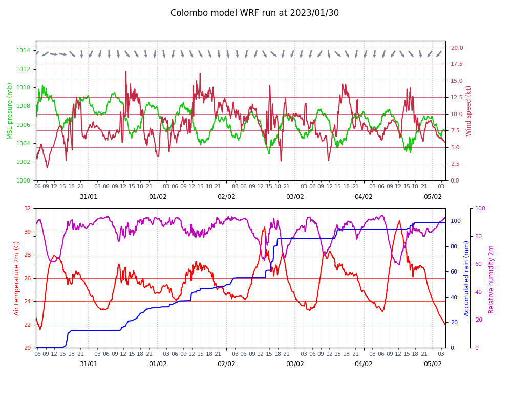
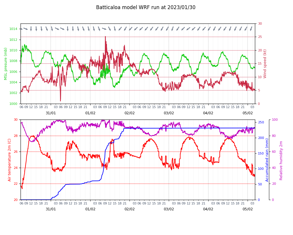
A tropical depression will hit Sri lanka in the next 24-48 hours with strong winds along east and west coasts
The depression over the Southeast and adjoining Southwest Bay of Bengal, lay centered near latitude 8.1°N and longitude 85.3°E, about 455 km east-southeast of Trincomalee. It is likely to move west-northwestwards till evening of 31st January then recurve gradually south-southwestwards and cross Sri Lanka coast in the forenoon of 01st February 2023. Showers or thundershowers will occur at times in Northern, Eastern, North-Central and Uva provinces and in Matale and Hambantota districts. Sowers or thunder showers will occur at several places elsewhere during the afternoon or night.
Very heavy showers about 150mm are likely at some places in Eastern, Uva and Central provinces and in Polonnaruwa district. Heavy showers above 100mm are likely at some places in North-Western and Northern provinces and Anuradhapura district.
Strong winds about (50-60) kmph can be expected at times over the Eastern, Uva, Western, Central and Sabaragamuwa provinces and in Galle, Matara, Mullaitivu, Jaffna and Kilinochchi districts.
(Source : www.meteo.gov.lk)
Can access through the weather forecast model created by “The University of Western Australia” by following links.
1. http://myocean.mywire.org/SRILANKA/wrf_d01_wind.gif
2. http://myocean.mywire.org/SRILANKA/wrf_d02_wind.gif
The second link is for WRF at 2km resolution. The latest model run will be completed in `~30 mins and will be available from same link.
2KM Resolution
Go through http://myocean.mywire.org/SRILANKA for more details of surface wind, surface temperature and MSL preasure over Sri Lanka


