ARGO DATA
BOUNDARIES

COASTAL FORTS
CROWDSOURCED BATHYMETRY
FISHERY HARBOURS

FISHING GROUNDS

INFORMATION FUSION CENTER BULLETINE
IUU FISHING

LIGHTHOUSES
MARINE INCIDENTS

MARINE MAMMALS & SEA TURTLES
MARINE TRAFFIC
MARINE WEATHER

SRI LANKA OCEAN
WEATHER FORECAST
WEATHER FORECAST
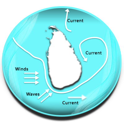
OCEAN CURRENT
SHIP WRECKS

SUBMARINE CABLES
SURFING

TSUNAMI WARNING TOWERS

WIND FARMS

LIFE SAVING POINTS

FLIGHT RADAR 24

CLCS
REEFS